
September 29, 2026
July 2026 Fontainebleau Forest Fire: What Happened to the Hiking Trails?
July 2026 Fontainebleau Forest Fire: What Happened to the Hiking Trails?
A familiar trail can change status after a wildfire. In Fontainebleau, an open car park or a waymarked path does not guarantee that an entire hike is permitted. The supplied account describes a phased reopening of the forest as of September 9, 2026. Its dates, figures and closures nevertheless need to be confirmed with the authorities before publication or a hike. The practical rule is straightforward: check current official information and turn back wherever access is prohibited on the ground.
What is known about the July 2026 fires?
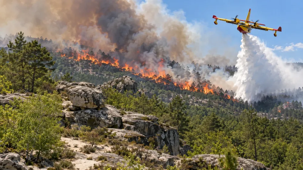
According to the account provided, the fires began on July 12, 2026, affecting the Trois-Pignons state forest and the Faisanderie and Grand Parquet areas. Around 2,000 hectares, or nearly 10% of the forest, were reportedly burned, including four biological reserves. The fire was reportedly declared extinguished on August 29, following extended monitoring for remaining hot spots. These details are not, on their own, a verified official assessment: updates from the Seine-et-Marne prefecture should be checked for binding orders and current instructions.
The disappearance of visible flames does not necessarily mean the danger has passed. In a forest where sandy paths meet rocky ground and wooded plots, safety depends on the condition of individual trees, soils and access routes—not simply on how the landscape looks.
Which hiking trails might be accessible?
The timeline in the supplied account says that approximately 18,000 hectares, or 80% of the forest, reopened on August 22, 2026. It then puts access at around 20,000 hectares, or nearly 90%, from September 1. Even if confirmed, these figures cannot establish whether a particular circuit is open: burned plots, safety buffers and paths awaiting work may remain closed within an otherwise accessible forest.
Before selecting a route, check the ONF interactive access map, then review any prefectural orders. An old GPX track, a printed guide or an open car park does not prove that nearby paths are passable. Detours affecting blue-marked trails, GR long-distance routes or riding circuits may change; temporary signs on the ground must always be respected.
Why can a burned area remain dangerous?
A tree that still looks green may have weakened roots or a damaged trunk. Branches can fall without an obvious warning, while burned roots may leave unstable ground or cavities that are hard to spot. Depending on conditions, residual heat or a renewed outbreak can also justify a continuing safety perimeter. Closures help preserve access for emergency crews and forestry teams as well.
Trois-Pignons, Faisanderie and Grand Parquet are broad areas, not a list of closed paths. To establish whether a hike is allowed, compare its exact route with the ONF map and follow signs on site. Never go around a barrier or temporary fence, even to reach a viewpoint only a short distance away.
How can a hike be planned safely?
Planning may start the night before, but the final check belongs on the day of departure: ONF map, prefectural updates, weather and any detours. Heat, wind or dry conditions can change access arrangements and make a long loop more demanding. Choose a route confirmed open throughout and keep a shorter alternative, rather than relying on an uncertain crossing halfway through the day.
Bring water, footwear suited to sand and rock, a charged phone, and share the planned route with someone. Resources from the French Hiking Federation can help with general preparation, but no app overrides a closure sign. If smoke or a new fire appears, move away, call 18 or 112, provide a precise location and follow emergency instructions. Do not approach for photographs.
A recovering forest with changing access
Restoration does not end when most of the forest reopens. Making trees safe, checking paths, adjusting signs and observing natural regeneration may lead to further openings—or keep some areas closed. Staying on permitted trails protects damaged soils and gives forestry teams room to work. For changes, the ONF access page is more useful than a weeks-old screenshot.
The short answer
Much of Fontainebleau may be accessible according to the supplied account, but reopening the forest does not mean reopening every trail. Check official updates and the exact route before leaving; on site, respect every closure and choose another loop if access is prohibited or unclear.
FAQ
Had every trail reopened by September 1, 2026?
No. The approximately 90% access figure comes from the supplied account, requires confirmation and says nothing about every individual route. Check the ONF map and current orders for a specific hike.
How are closed trails marked in the forest?
On the ground, closed areas are marked with temporary barriers, “ganivelles” (wooden slat fencing) and “no entry” or warning signs. When a waymarked route crosses a closed area, a detour is put in place. This applies to the blue trails, the GR long-distance routes and the equestrian circuits. These detours are being added gradually and may change. On-site signage works alongside the ONF’s regularly updated interactive map and the Seine-et-Marne prefecture’s orders. If a sign contradicts your GPX track or guidebook, the sign always takes priority. Never cross a barrier or walk around a fence, even if the area looks quiet. If you are unsure whether a path is open, turn back or choose another route.
Can an old GPX track be followed through a closed area?
No. Older tracks do not reflect temporary restrictions. Follow an authorized detour or choose a different circuit.
Is it safe to cross a burned plot that looks quiet?
Not if access is prohibited. Weakened trees and unstable ground can pose hazards that are difficult to see.
What should hikers do if smoke appears?
Move away without approaching to investigate, call 18 or 112, and tell emergency services the location.